Mapping Lorawan coverage in Kyrgyzstan

In a pioneering initiative, the Internet Society Kyrgyz Chapter has embarked on a groundbreaking project to test and map LoRa-enabled
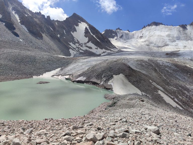
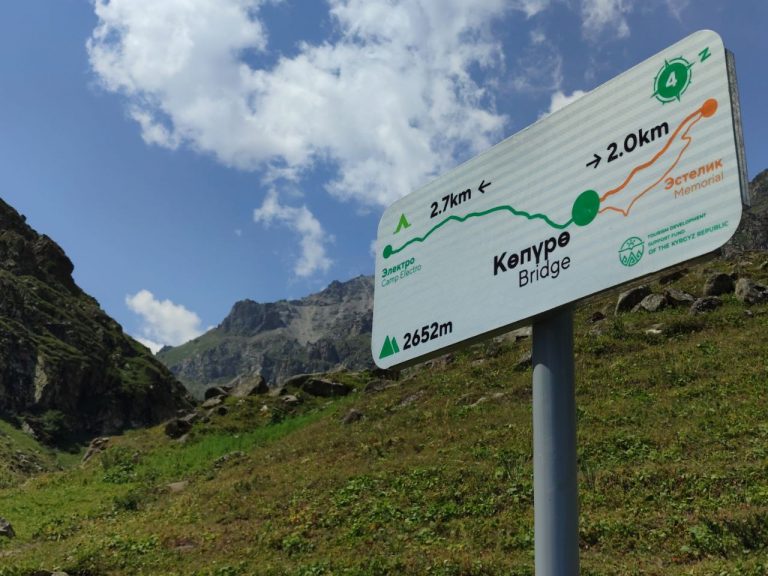
 gateway coverage in select pilot locations. This endeavor marks a significant leap forward in the realm of Internet of Things (IoT) technology, aiming to enhance connectivity, streamline data collection, and fortify research efforts.

Mapping LoRa-enabled gateway coverage is a crucial step in advancing IoT infrastructure of the country. LoRa (Long Range) technology, known for its extended range and low power consumption, is increasingly employed in diverse applications, including environmental monitoring, agriculture, and smart city solutions. The success of these applications relies heavily on the optimal placement and coverage of LoRa gateways.

The process of mapping LoRa-enabled gateway coverage involves a meticulous survey of the targeted area, considering topography, geographical features, and potential interference. The ISOC Kyrgyz Chapter, in collaboration with local partners, is employing cutting-edge techniques to identify strategic locations for LoRa gateways. These gateways serve as crucial communication hubs, facilitating the seamless transfer of data between IoT devices and the central network.

The benefits of mapping LoRa-enabled gateway coverage are manifold. Firstly, it ensures that IoT devices within the coverage area can efficiently communicate with the network, enabling real-time data transmission. This is particularly vital for research initiatives focused on environmental monitoring, where timely and accurate data is imperative for informed decision-making.

Secondly, the strategic placement of LoRa gateways optimizes network efficiency, reducing the chances of signal interference and packet loss. This, in turn, enhances the reliability and stability of IoT applications, making them more robust in challenging environments.

From a research perspective, the mapped data provides valuable insights into the performance and limitations of LoRa technology in specific geographic contexts. Researchers can analyze coverage patterns, identify potential dead zones, and fine-tune gateway placements for maximum efficacy. This iterative process of testing and mapping contributes to the continuous improvement of IoT infrastructure, fostering innovation and advancements in diverse fields.

In conclusion, the ISOC Kyrgyz Chapter’s initiative to test and map LoRa-enabled gateway coverage in pilot locations is a commendable stride towards harnessing the full potential of IoT technology. By strategically placing gateways and optimizing coverage, this effort not only enhances connectivity and data reliability but also lays the groundwork for transformative research endeavors that leverage the power of the Internet of Things for natural disaster monitoring and prediction.

Trip to Adygene glacier mountain lake

21 июля исследовательская группа ISOC отправилась в экспедицию к ледниковому озеру Адыгене, стратегически расположенному в 60 км к юго-юго-западу от Бишкека. Это высокогорное ледниковое озеро, расположенное на высоте 3600 м в верховьях долины реки Адыгене, левого притока реки Ала-Арча является нашей следующей пилотной локацией для размещения IoT-датчиков, предназначенных для мониторинга паводков, вызванных прорывами ледникового озера.

Адыгене, расположенный на морене ледника, включает в себя еще три озера на юге и юго-востоке. Самое юго-восточное озеро, расположенное на высоте 3640 метров, образовалось вдоль северного края ледника, южным берегом примыкая к самому леднику. Озеро имеет длину 188 метров и ширину 70 метров в самом широком месте, имеет периметр 550 метров и площадь 17 142 квадратных метра. Ручей течет с северо-восточной стороны и после 330-метрового пути сливается с небольшим моренным озером. Кроме того, в южной части озера расположены еще десять небольших моренных озер.

Под руководством нашего партнера – Института водных проблем АН КР – на ледниковом озере Адыгене проводиись мониторинги с использованием различных технологических средств. Станция Адыгене, созданная в 2008 году, играет ключевую роль в изучении высокогорных озер и ледников, одновременно защищая местное население от потенциальных прорывов. Рядом со станцией установлена традиционная метеорологическая станция, где исследователи вручную собирают ежедневные данные с помощью датчиков и получают информацию с автоматической станции.

Первоначально из-за отсутствия покрытия мобильной связи использовалась геостационарная спутниковая связь. Однако из-за бюджетных ограничений от этого варианта отказались, учитывая непомерные для бюджета Института ежемесячные расходы в размере от 200 до 500 долларов США на связь.

Признавая наличие прямой видимости с определенных участков с базовыми станциями Чуйской долины, исследовательская группа Кыргызского отделения ISOC и ICTP предложила внедрить LoRaWAN технологию, которая могла быть обеспечить круглосуточный мониторинг в режиме реального времени, 7 дней в неделю по более доступному ежемесячному тарифу на подключение к GSM за 3 доллара.

Руководствуясь этим стратегическим обоснованием, члены Кыргызского отделения ISOC и стажеры Института водных проблем отправились в утомительный шестичасовой поход к месту происшествия. Путешествие характеризовалось сложным рельефом, переходом от жаркой летней погоды к дождливой и ветреной погоде, сопровождавшейся колебаниями температуры до 20 градусов.

Достигнув пункта назначения, команда тщательно оценила возможности подключения, определила потенциальные места для установки коммуникационного шлюза, определила типы необходимых измерений и датчиков и наметила необходимые установки мачт. После напряженного дня поздно вечером команда вернулась на главную дорогу национального парка Ала-Арча. На основе собранных данных был сформулирован комплексный план работ и логистики для установки инфраструктуры Интернета вещей на ледниковом озере Адыгене.

Ongoing maintenance ensure optimal performance of lora-enabled sensors

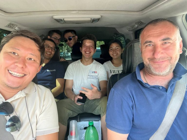
The ISOC Kyrgyz Chapter team has been actively engaging in routine maintenance visits to our pilot locations. Since the initial installation of LoRa-enabled sensors, certain units have necessitated additional on-site attention to ensure optimal performance.

In some instances, ensuring the proper functioning of sensors called for tasks such as excavation from the soil, recalibration, and subsequent reburial. In other cases, the effective operation of sensors demanded the application of specific, albeit previously undocumented, installation techniques. Additionally, challenges arose in certain cases due to inconsistent sensor quality from specific vendors.

To address these complexities, interns from the Institute of Water Problems were actively involved in the process. Their participation served a dual purpose – to offer hands-on training and education and to facilitate the exchange of expertise with students.

As we continue to progress through the data collection stage of our research project, these maintenance efforts remain instrumental in ensuring the accuracy and reliability of our LoRa-enabled sensors in diverse environmental conditions.

LoraWan IoT Data Dashboard

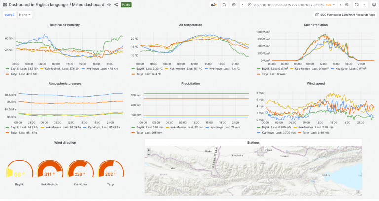
The team created beta version of the dashboard visualization of the project data collected from pilot locations.

The dashboard represents visualization of the following data: relative air humidity, air temperature, solar irradiation, atmospheric pressure, precipitation, wind speed, wind direction. The other dashboard represents visualization of the following data: soil moisture and precipitation, water level. Dashboards are available in Kyrgyz, English and Russian languages. Some dashboards are specially designed for local communities to use for the benefit of community.

We believe in open source solutions. That’s why we use Grafana – a multi-platform open source analytics and interactive visualization web application.The information gathered from Lora-enabled sensors through Lorawan communication gateways and transmitted to the central server via GSM network. Collected IoT telemetry data stored on servers and then visualized using Grafana software. Up-to date information is available via link: http://dashboard.isoc.kg

Note. Since its scientific project, some publicly available data may have wrong parameters or data due to internal experiments, settings, tuning, etc. Please consult before use in research purposes.