From Mountains to Data – Insights from RIPE 89

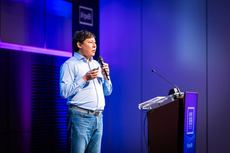
The RIPE 89 Meeting, held in Prague, brought together a vibrant mix of technology enthusiasts and industry experts to share knowledge on data, networking, and innovation. Organized by the RIPE Network Coordination Centre (RIPE NCC), this annual gathering serves as a crucial forum for fostering collaboration and exchanging ideas within the global internet community. One of the standout sessions was “From Mountains to Data,” presented by Aziz Soltobaev under the RIPE Academic Cooperation Initiative (RACI). This talk illustrated the journey of turning raw natural data into valuable digital insights.

In his presentation, Aziz Soltobaev discussed how immense, raw data sourced from the natural world can be transformed into actionable information. This theme transcends theoretical discussion and dives into practical solutions for collecting, managing, and analyzing vast environmental data sets. The metaphor of mountains symbolized both the physical challenge of remote data collection and the inherent complexity of processing unrefined data.

In his presentation at RIPE 89, Aziz Soltobaev emphasized the challenges of data collection in Kyrgyzstan’s mountainous regions, stating, “Deploying sensors in these remote areas is not just about technology; it’s about overcoming logistical hurdles and ensuring data reliability.”

Key Insights and Technological Challenges

Data Collection in Remote Areas: Soltobaev highlighted the difficulties encountered when gathering data in rugged, mountainous regions. Deploying sensors, ensuring reliable data transmission, and dealing with extreme conditions demand both creative problem-solving and technological ingenuity.
Advanced Data Processing: After collection, raw data must be processed to uncover valuable insights. Soltobaev underscored the importance of powerful computational tools like machine learning algorithms and high-performance computing to effectively analyze and interpret this data.
Transforming Data into Decisions: The ultimate aim of this data transformation is to support informed decision-making in areas such as environmental preservation, urban development, and disaster preparedness. Soltobaev provided examples where analyzed data was used to predict natural events and assess their potential impact on communities. “By transforming raw environmental data into actionable insights, we can make informed decisions in urban planning and disaster preparedness, ultimately benefiting our communities”, Aziz said.

Relevance for Networking and Technology Experts
This topic holds significant relevance for the RIPE community. Soltobaev’s insights highlighted parallels between challenges in environmental data handling and the complexities of managing global network infrastructures. Both require scalable, resilient systems capable of adapting to varied and sometimes overwhelming data demands.

Future Perspectives
The presentation “From Mountains to Data” underscored a broader message: the convergence of data, technology, and environmental understanding can lead to innovative, cross-disciplinary solutions. By tackling complex data with the right tools and methodologies, what once seemed insurmountable can be turned into actionable knowledge that benefits multiple sectors.

This session at RIPE 89 emphasized that, with determination and the right technological strategies, even the most challenging data can be harnessed to pave the way for smarter, data-driven decision-making across environmental and technical landscapes.

Additional links:

  • https://ripe89.ripe.net/programme/meeting-plan/iot-wg/
  • https://ripe89.ripe.net/programme/blog/
  • https://ripe89.ripe.net/archives/video/1476/

From Mountains to Data Low-Cost Weather Stations in Kyrgyzstan’s Challenging Terrain

On behalf of the research team, I am very pleased to announce that our preprint of a research paper on the use of low-cost automatic weather stations, LoRaWAN technology and various IoT sensors has been published. “From Mountains to Data: Low-Cost Weather Stations in Challenging Conditions in Kyrgyzstan” describes the selection criteria for the equipment to be deployed and provides detailed information on the installation process at the pilot sites, as well as the challenges encountered during the project.

For me, one of the main conclusions of this research project is that there has been a significant breakthrough in the quality and availability of telemetry sensors over the past five years.

Our data analysis shows that two-tier automatic weather stations demonstrate similar results (daily, decadal, monthly averages) with a high degree of accuracy (95-98%) as the first-tier AWS. The only difference is that new technologies have reduced the cost of weather stations by 10-20 times. Instead of $50,000 worth of equipment, you can use $1,000-$5,000 weather stations and get identical results (subject to regular calibration and maintenance of the equipment).

The second important takeaway is the demonstration of the potential of LoRaWAN data transmission technology for rapid deployment and monitoring of climate change, creation of geoinformation models, forecasting future trends, and taking mitigating preventive measures.

The third important takeaway is the practical application of such an approach to data transmission as Delay-Tolerant Networks. With this approach, under adverse external conditions, data can be collected and transmitted later. In the conditions of the pilot project in Kyrgyzstan, DTN showed good performance in severe frost conditions in December 2023, when the temperature dropped to -23-28 degrees. As a result, some nearby cell towers were disconnected for a while, as were some of our sensors. However, data recording continued, and when the network was restored, the data was successfully transmitted to the central server.

The full version of this article will be published in the next issue of the scientific journal Sensors. This scientific work became possible during the implementation of the research project of the Internet Society Kyrgyz Chapter with the financial support of the Internet Society Foundation.

Lora-enabled IoT devices to improve community preparedness and response to disasters in Kyrgyzstan

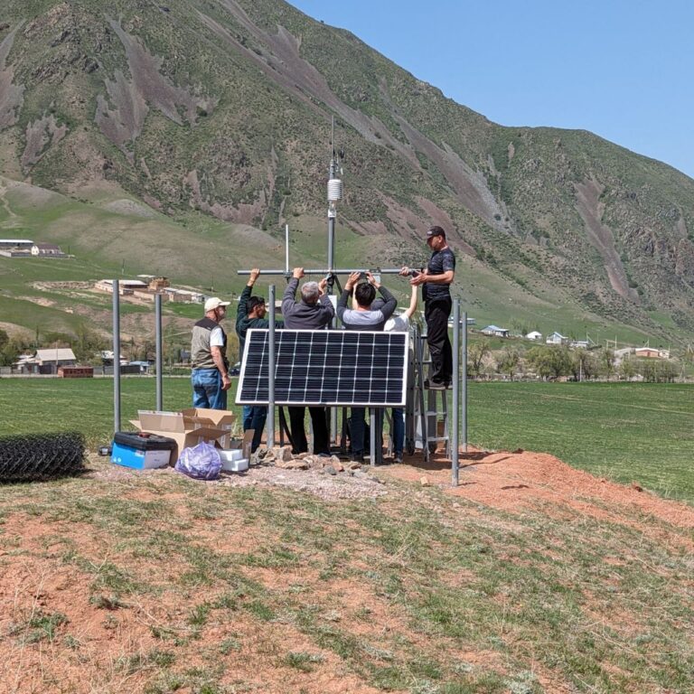
ISOC Research Team had received additional Lora-enabled devices designed to help rural communities and farmers residing near landslides improve well-beings.

Early on September, the Internet Society Kyrgyz Chapter had received request from the Ministry of Emergency Situations to install smart devices such as weather and landslide monitoring devices in the southern parts of the republic.

Desk research of the list of locations revealed that in some instances local communities live near the potential source of natural disaster. In the southern parts of the country, low-income families and communities are more vulnerable to consequences of natural disasters such as landslides, mudflows, earthquakes. Mostly because local residents primarily engaged in livestock farming and agriculture cannot afford better living conditions and economic opportunities in safer regions.

In the meantime, nowadays the scientific research project utilize the potential of Lorawan communication gateways for less than 1% of its capacity. Based on the available data, we decided to get more affordable low-cost Lora-enabled devices that could help farmers to grasp the potential of precision agriculture (smart farming) and improve their economic wellbeing.

In addition to the weather monitoring devices that should be installed in order to monitor pilot locations and help to build early-warning systems, we are planning to install sample devices to manage water irrigation of lands, monitor soil health and track animals gazing on landslides.

We plan to provide collected information in user friendly mobile interface and telegram bots so that local farmers could benefit most of technology as well as participate in monitoring of natural disasters.

The benefit of this initiative for the research project is securing the equipment integrity and data collection sustainability in the long term range.


#SmartFarming, #PrecisionAgriculture, #IoTinAgriculture, #SmartIrrigationSystems, #LoRaWANTechnology, #AgriculturalSensors, #ConnectedFarming, #WirelessSensorNetworks, #IoTDevicesforAgriculture, #FarmAutomation, #LoRaDevices, #AgriculturalMonitoring, #IoTinCropManagement, #DataDrivenAgriculture, #SustainableFarming, #PrecisionIrrigation, #SmartCropMonitoring, #FarmtoCloudConnectivity, #IoTSolutionsforAgriculture, #AgTechInnovations

Illustrative image of smart agriculture devices

Installation works on Adygene lake pilot location finalized

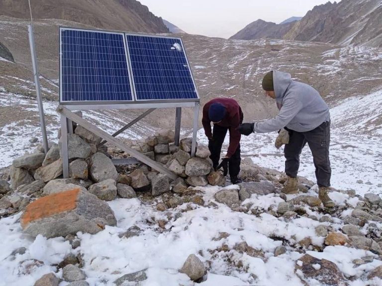
The review of installation works conducted on August and feedback from the installation team revealed that proposed scheme was not sustainable to weather conditions in the altitude of 3600m.

Based on consultations with the experts from CAIAG, Institute of Water Problems as well as ICTP, some changes had been proposed in carcass of the composition to keep photovoltaics as well as its location.

The installation team moved the structure from one hill to another, conducted welding and strengthening works on Adygene high mountain glacial lake.

Due to the delayed installation works, the research team were unable to setup Lorawan gateway and sensors this year. The cold weather conditions and expedition difficulties. We hope to finalize work by May, 2024.